
LIVE COVERAGE | MOJO PULSE BREAKING NEWS DESK | All times IST
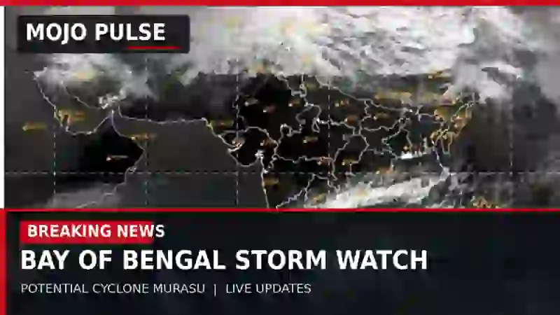
Latest status (31 October 2026): A well-marked low-pressure system over the southeast Bay of Bengal and adjoining Andaman region is expected to intensify. The name Murasu will apply only if the system attains cyclonic-storm intensity and is officially named. The timing and exact place of any coastal crossing have not yet been established by the IMD observations cited below. This is a developing forecast, not confirmation of cyclone formation or landfall.
LIVE UPDATES — Latest first
31 October 2026, 4:28 PM IST — IMD details Andhra coastal gale forecast and November 2–4 fishermen advisory
Newly reviewed official guidance, not a new storm classification: IMD’s national press release issued at 2:25 PM IST on 31 October gives detailed marine and public-safety warnings that were not in this live report’s earlier entries. Its 8:30 AM IST synoptic observation still classifies the separate Bay of Bengal system as a well-marked low-pressure area. Formation of a depression and subsequent cyclonic storm remain forecasts; the name Murasu is not confirmed by this release. IMD projects the system towards the west-central Bay near Andhra Pradesh by the evening of 2 November, not a verified coastal crossing at that time.
Andhra Pradesh coast — forecast winds and sea: IMD forecasts squally winds of 40–50 km/h, gusting to 60 km/h, from 1 November evening, strengthening to 65–75 km/h, gusting to 85 km/h, by 2 November afternoon and 80–90 km/h, gusting to 100 km/h, from 2 November evening to 3 November forenoon. Seas along and off the Andhra Pradesh coast are forecast to become high from 2 November afternoon to 3 November forenoon. These figures are forecasts, not observed wind speeds or a confirmed landfall intensity.
Fishermen advisory: IMD explicitly advises fishermen not to venture along or off the Andhra Pradesh coast from the morning of 2 November to the afternoon of 4 November; its separate warnings cover the west-central Bay from 1 November morning to 4 November afternoon, the southeast/east-central Bay on 1–2 November, and the south Odisha coast from 2 November evening to 4 November afternoon. This is an official IMD advisory, not a claim that a state government has imposed a legal fishing ban or evacuation order.
Rain and adjoining states: IMD continues to forecast isolated extremely heavy rainfall in Coastal Andhra Pradesh and Yanam on 2 November, very heavy rain there on 3 November, very heavy rain in Rayalaseema on 2–3 November and isolated very heavy rain in Odisha on 3–4 November. The latest nationally issued release also reports 16 cm at Panagarh, Gangetic West Bengal during the 24 hours ending 8:30 AM on 31 October. That is an observed earlier rainfall total, not evidence that the new Bay system has already affected Kolkata or West Bengal. IMD Kolkata’s 2:00 PM coastal bulletin still lists no West Bengal port signal or storm-surge warning.
Preparedness verification: No new school closure, evacuation order, port shutdown, railway suspension or confirmed coastal impact from this new system is established by the documents reviewed here. Do not confuse earlier Cyclone Arnab response measures with orders for the current system.
Source and time: IMD national press release, issued 2:25 PM IST on 31 October 2026 (synoptic observation 8:30 AM IST; wind/sea and fishermen warnings, pp. 1–3); IMD ACWC Kolkata coastal bulletin, issued 2:00 PM IST; Times of India, Visakhapatnam, updated 2:14 PM IST, corroborating the developing system and Andhra rain risk. Editorial review: 4:28 PM IST.
31 October 2026, 3:29 PM IST — IMD confirms well-marked low at 8:30 AM; Andaman port caution signal remains in force
Official observation versus forecast: The IMD’s 1:59 PM IST sea-area bulletin and 2:00 PM IST coastal bulletin, both issued on 31 October, place the system as a well-marked low-pressure area at the 8:30 AM IST observation over the southeast Bay of Bengal and adjoining Andaman waters. IMD forecasts development into a depression within six hours of that bulletin’s reference period and possible cyclonic-storm intensity during the following 24 hours. The forecast has not, by itself, confirmed that either intensification has occurred or that the system has been officially named Murasu.
Marine and port guidance: The IMD coastal bulletin says Local Cautionary Signal No. 3 should remain hoisted at Sri Vijayapuram port in the Andaman and Nicobar Islands. For Andaman coastal waters it forecasts 20–25-knot winds, gusting to 30 knots, and moderate to rough seas, occasionally very rough. The sea-area bulletin also forecasts rough to occasionally very rough conditions over parts of the southeast Bay. These are forecast marine conditions, not an observed coastal impact or a blanket fishing-ban order.
Andhra Pradesh: IMD’s 31 October subdivision warnings retain extremely heavy rain at isolated places in Coastal Andhra Pradesh on 2 November and very heavy rain in Rayalaseema on 2–3 November. The Times of India, in a Visakhapatnam report updated 2:18 PM IST, identifies Krishna, Guntur, NTR, Palnadu and Bapatla among districts at risk of heavy to very heavy rain on 2–3 November, citing IMD guidance. The system is forecast to reach waters near the Andhra Pradesh coast by the evening of 2 November; no exact landfall location or time is confirmed by these bulletins.
West Bengal check: IMD’s 2:00 PM Kolkata coastal bulletin lists no port signal and no storm-surge warning for the West Bengal coast, with smooth sea conditions forecast locally. This does not preclude later changes.
Source and timing: IMD ACWC Kolkata sea-area bulletin (issued 1:59 PM IST; synoptic observation 8:30 AM); IMD ACWC Kolkata coastal bulletin (issued 2:00 PM IST; synoptic observation 8:30 AM); IMD Amaravati subdivision warnings (31 October); Times of India Visakhapatnam (updated 2:18 PM IST). Editorial review time: 3:29 PM IST.
31 October 2026, 2:25 PM IST — IMD raises rain warnings for Andhra Pradesh as new Bay system strengthens
Confirmed forecast information: The IMD Meteorological Centre at Amaravati has issued warnings dated 31 October for extremely heavy rain at isolated places in Coastal Andhra Pradesh on 2 November, followed by very heavy rain on 3 November; Rayalaseema has very heavy rain warnings for both 2 and 3 November. Lightning, squalls and strong surface winds are also listed.
IMD’s morning situation report, carried by United News of India, places a well-marked low-pressure area over the southeast Bay of Bengal and neighbouring Andaman region at 5:30 AM IST. It is expected to become a depression, intensify further and approach the west-central Bay of Bengal near the Andhra Pradesh coast by the evening of 2 November. Approaching the coast is not the same as confirmed landfall.
Storm name status: Regional reporting identifies Murasu, a name proposed by India, as the next name in sequence if a cyclonic storm forms. This article will use “potential Cyclone Murasu” until an official cyclone bulletin confirms the naming.
Sources and issued times: IMD Amaravati subdivision warnings (31 October); UNI report citing IMD’s 9:01 AM bulletin; Dinamani reporting on proposed name (31 October).
What is known so far?
- System: a fresh Bay of Bengal low-pressure system, separate from the remnants of Cyclone Arnab.
- Forecast movement: broadly west-northwest toward the waters near Andhra Pradesh by 2 November.
- Current classification: do not call it a named cyclonic storm unless and until confirmed in an IMD cyclone bulletin.
- Highest identified rain risk: coastal Andhra Pradesh, particularly 2–3 November; local district conditions may differ.
- Unconfirmed: exact landfall point and time, peak winds, eventual named-cyclone status and district-specific impacts.
Andhra Pradesh: heavy rain, strong winds and sea conditions
Coastal districts and Rayalaseema face periods of intense rain and thunderstorms, with hazards including local flooding, waterlogging, tree damage and transport disruption. Fishermen and coastal residents should check the latest official bulletins before going to sea. Do not treat forecast-model landfall probabilities as equivalent to official IMD landfall warnings.
What this means for Kolkata and West Bengal
The latest guidance reviewed here principally concerns the southern and central Bay of Bengal and the Andhra Pradesh coast. It does not establish a cyclone landfall in West Bengal or a direct Kolkata cyclone warning from this new system. MOJO PULSE will add any West Bengal-specific rain, wind or marine alert if IMD issues one.
Storm tracking and public safety sources
- India Meteorological Department — national updates
- IMD Amaravati — coastal Andhra Pradesh warnings
- RSMC New Delhi — official tropical cyclone bulletins
- AP Disaster Management weather watch (model guidance, not official IMD warning)
Background: following Cyclone Arnab
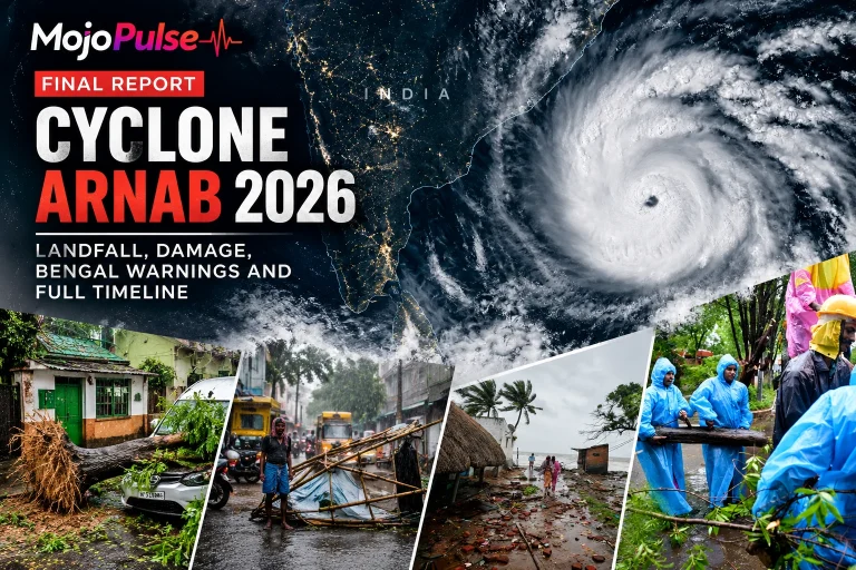
The new system is distinct from the storm that struck the Andhra Pradesh–Yanam coast earlier in the week. For the full earlier event chronology, see MOJO PULSE’s Cyclone Arnab final report.
Editorial protocol: this running article is arranged newest first. Each substantive update carries an IST timestamp and linked source. Forecasts, agency observations, model guidance and official instructions are labelled separately. Earlier entries remain available as the forecast evolves.


Reader discussion
Join the conversation respectfully. Your email address will not be published. Comments are reviewed before appearing.